
Going to the peak is not an easy ride all the way. Many will stay camping for atleast 3 days 2 night in order to complete the trip. You have to make way thru the thorny trees, fallen trunks, sharp bamboo edges, and more others that will surely make your hiking life challenging.
GETTING THERE
There are many ways to get here. For me, we start our way by driving from Kuala Lumpur to Cameron Highlang, follow the PLUS Highway and exit at Tapah. When we reach Cameron Highland (after few hours driving), we make our way to Masjid Lojing, a big Mosque, which probably the main one in Cameron Highland. Here we gather our stuff and get ready with our gear before we proceed to the entrance of Hutan Simpan Loging.
THE BEGINING
We start our day early in the morning, around 7.30am. We park our car at the near by Orang Asli village. A lot of people going up today. Some come here with even a bus full. Others are same like us.


After the parking, you will have to cross a river via an old wooden bridge (the thrill even starts here).

Then you will see few Orang Asli houses, where you have no choice but to walk pass thru it. Here we make our final checks and do some exercise before we proceed.


After the the village, you will have to walk for quite a while. Walking pass thru a muddy road, crossing a river, and walk across a track full of bamboos, this journey will take you at least one and a half hour before you reach the first check point, which is Sungai Regil.

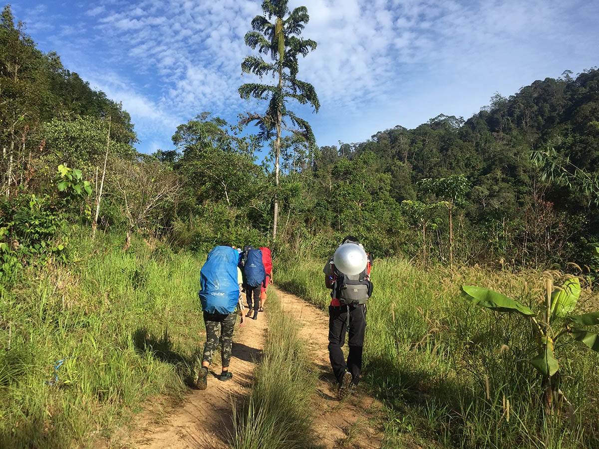


The time is 10.30am. We stop here for rest, while waiting for others to regroup. Having our lite breakfast with cooking some instant noodles and a warn jug of tea. Thrust me, it is worth the stop, as the road a head of us is still a long way to go.


After a good rest, we proceed our way toward the next stop. The time is now 11.30am. Along this way is not much different then the track before, you still have to keep repeating the same process. Just that the distance is quite far this time, which will take you 5 hours of walking.
After a few stops along the way, finally we reach our campsite, Kem Agas. We reach here somewhere around 4.30pm. It's quite big and comfortable space to build camps here. From the look, it can accomodate between 50 to 100 people at one time.


The campsite have an easy access to water point, as there is a river nearby. Without further delay, we set out our camp, cook for dinner, wash ourselves, get some rest, and get ready to face another challenge tomorrow, which is, the long muddy and mossy way to the summit.


No comments:
Post a Comment