
Getting here would take you one and a half hours driving from Kuala Lumpur, or just 20km from Seremban town. There are 2 entrance to enter this mountain. One is from Bukit Putus, and one is from Ulu Bendul Recreational Park.
Entering from Bukit Putus would take lesser time to reach the top, compared to entering from Ulu Bendul Recreational Park. The different is around 2 hours time. As for this trip, my team is entering from Bukit Putus, and going down toward Ulu Bendul.
You will notice a guard house, and a steps going up, telling you that this is the starting point. Before going up, you must pay RM5 for the permit, or else, they won't let you enter.


The first 20 to 30 minutes is quite tough, as the slope and the gradient that need to hike is quite slanting (around 40 to 45 degree). You will find some kind of a resting point here, where you can rest.
Continue your way straight until you reach the view point. If you reach here, then you know that your distance is not so far ahead. Roughly after 2 hours walking (starting at 9.30am), we manage to reach the peak (roughly 11.30am).


The peak is quite big, enough space for you to camp and take photo. Three spots for photo here, which is two showing the marker, and one up ahead (not so far), an old Beirut.


( with Datuk Khalid Yunus )

We spend roughly 2 hours here, before we make our way down, following the trail to Ulu Bendul. Like I said earlier, going down using this route is far more further then coming up from Bukit Putus. Make sure you have enough water as the trail will took you roughly 4 hours to reach the ground.
You will meet some slopes at Bukit Botak (which you will have to use rope to go down), then, an old camp site, Kem Tangga Batu, and finally, a river, which you have to cross. You can stop here for a while to rest before making your way further. Later after a while, you will see the river is getting bigger (in size) and people picnic around, this shows that your distance is not so far ahead.


You know you reach your destination after you see a lot of resting and picnic spots for visitors, and a pool. Well, you can rest well my friend, your tracking is over. Well done !


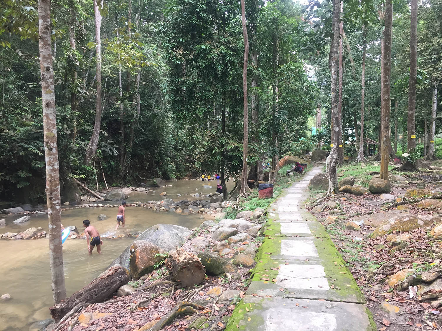

The facilities down here is awesome, where there is a toilet, surau, and even a restaurant, where you can eat. Snacks and drinks can be obtained at the park entrance.


Ulu Bendul is suitable for family, if you not planning to hike. The track is quite tough, but well rewarded.
This park is managed by the Negeri Sembilan Forestry Department, whose contact details are:
Jabatan Perhutanan Negeri Sembilan,
Block C, Tingkat 4,
Kompleks Setiausaha Kerajaan,
70503 Seremban,
Negeri Sembilan.
Email : webjpnns@gmail.com
Phone : 06-765 9849
Fax : 06-762 3711


No comments:
Post a Comment