Ok, here's how ...
Exploring Telapak Buruk
Since we want to save time, and don't want to hike till night, we plan our way from top to bottom, rather then going up, and come back down.
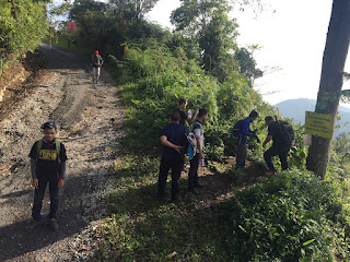
Our journey starts at 6.30am, drive straigh to the parking site (which is, the Lodging Area), pack our bags/gear, and ride a lorry. This lorry will bring us up strait to the top, which is, Telapak Buruk's Peak. The distance from the parking site to the top is quite long, roughly 1 hour plus. Imagine how long you have to walk, compare to driving within 1 hour ?
You know when you reach the peak after you see a huge telecom tower. The lorry will drop you here, and the you can start your way hiking down.
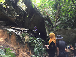
RAF B24 ( World War II Plane ) Crash Site
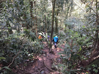
The distance from Telapak Buruk peak to this crash site is roughly 2 hours. You will walk downward towards the dry jungle. A good warming up for your early day.
We reach here roughly 9.00am. From the marking point, you can see a plane part on your left. This is just part of the plane. There are many more of its remaining below. You just need to hike a bit more. You can rest here a while before continuing your journey.
There are a lot of remaining parts as you go deeper and deeper downwards. Well, honestly, it is a bit tiring going down, but believe me, its worth the time. Spend your time here a bit taking photos or just admire the view, before going up to the marking site and continue your way to Gunung Berembun's peak.
Gunung Berembun Peak
From the crash site, you need to walk your way downward (again) thru the dry jungle. It will take you roughly 2 hours to reach the peak. Normally, people will just hike from below to Berembun's Peak. It consider a Trans to walk from Berembun to Telapak Buruk, as the mountain is both connected. We manage to reach here around 11.30am.
The peak here is not so big, and, there is also no view. All you see is a descent space for rest / camping, and a marking Beirut. Normally people will rest here quite a while and take photos, before they proceed on going down.
Gua Kambing
After 2 hours spend on top of Berembun's Peak, we continue our way down to Gua Kambing. Gua Kambing is consider a resting point for hikers. It has a place to seat, and also, a water point for you to refill your water. There also a surau here for hikers to pray. From Berembun's Peak to Gua Kambing will take your roughly 3 hours of walking.
Lata Berembun
From Gua Kambing to Lata Berembun, we will need to walk roughly 2 hours. Here is a perfect spot for picnic, or even take a bath and enjoy the cold river water. The view is nice, and the water is quite tempting. Worth the time spend here. We manage to reach here around 5.00pm.
This is not the end of the journey. Bare in mind that you have to walk another 2 hours more before your reach back the parking area, near the Lodging Area. After that, everything is finally return. We manage to reach the parking area around 7.30pm. Just nice before the day gets dark.
Thank goodness all of us manage to get down safely. Overall, the trip is quite awesome and enjoyable.


